My first via ferrata was at Ramales in Spain last month. Despite the heat, I found it fairly short and not too challenging, but I wanted more! Scott gifted me with a set of lanyards for my birthday, and so we decided to book a trip to the Italian Dolomites - the home of via ferrata. Most of the flight from Manchester to Milan was spent poring over the guidebooks and trying to figure out what routes were accessible to us. At this time of year, the summer climbing season is drawing to a close, many of the popular chair lifts are closed, and the Dolomites start gearing up for the skiing season. The upside to going in late September is the weather is usually calm and the climbing routes are nice and quiet.
 |
| Duomo |
Upon arriving in Milan we collected the hire car, checked into our apartment and went off to explore the city by night. We went to the Duomo and walked around all the designer shops feeling like complete scruffs in our north face t-shirts around all these beautiful people. I am almost certain the tramps were better dressed than us! We had a fairly early night, wanting to be up at a good time in the morning to head to Lake Garda and start our via ferrata adventure.
 |
| Lake Garda |
The drive to Arco at Garda took around 4 hours, with a stop off at Decathlon and a supermarket near Brescia to grab some camping supplies and food. Upon seeing the lake the mood completely changed, and we started getting excited. Now the real holiday starts. The first via ferrata route we chose is called Sentiero Attrezzato dei Colodri, described as a 2A (this is a little over the top, lanyards are hardly needed). It's a very easy introductory VF, around 300 metres long. From the finish, there's a short scramble to the summit of Monte Colodri at 97 metres above the surrounding terrain, or 400 metres above sea level. Despite starting the climb late in the day, around 5.00pm, it was still incredibly hot on the mostly exposed south facing route. At the summit was a large metal cross, and a log book.
 |
| Me writing in the log book, photo by Scott |
The views on the hike down were stunning, I really wanted to walk to the castle, but we didn't have all day to find a camp for the evening, and were getting hungry. We found ourselves emerging at the back of the town, and walking past lots of amazing ice cream parlours and ice cream shops. Alas both of us had left our money in the car, and we did not end up going back into Arco. Instead finding a nice campsite further along the road, pitched up and made food just in time before it went dark.
 |
| Monte Colodri |
Wednesday started later than planned, which was not good news as we had a much harder day of hiking and climbing on our hands. We would be starting the walk in at midday, so heat would be sapping us early too. After a short drive to Riva del Garda, and finding somewhere to park, we set off on what we expected to be an hour or so of hiking to get to the VF route. Ferrata del Centenario SAT - or Via dell'Amicizia, is graded a 3A climb, around 650 metres long. We severely underestimated the amount of time it would take us to reach the VF; it was around 4 hours of fairly intense hiking and scrambling. There is respite at 560 metres up in the Santa Barbara rifugio, which had just closed for the year. We took a break here and admired the view over Riva del Garda before slogging on ever upwards. Much sweat expired, much bemoaning of mountains, and a little wondering what the hell we were doing.
 |
| Having a well-earned rest at the top |
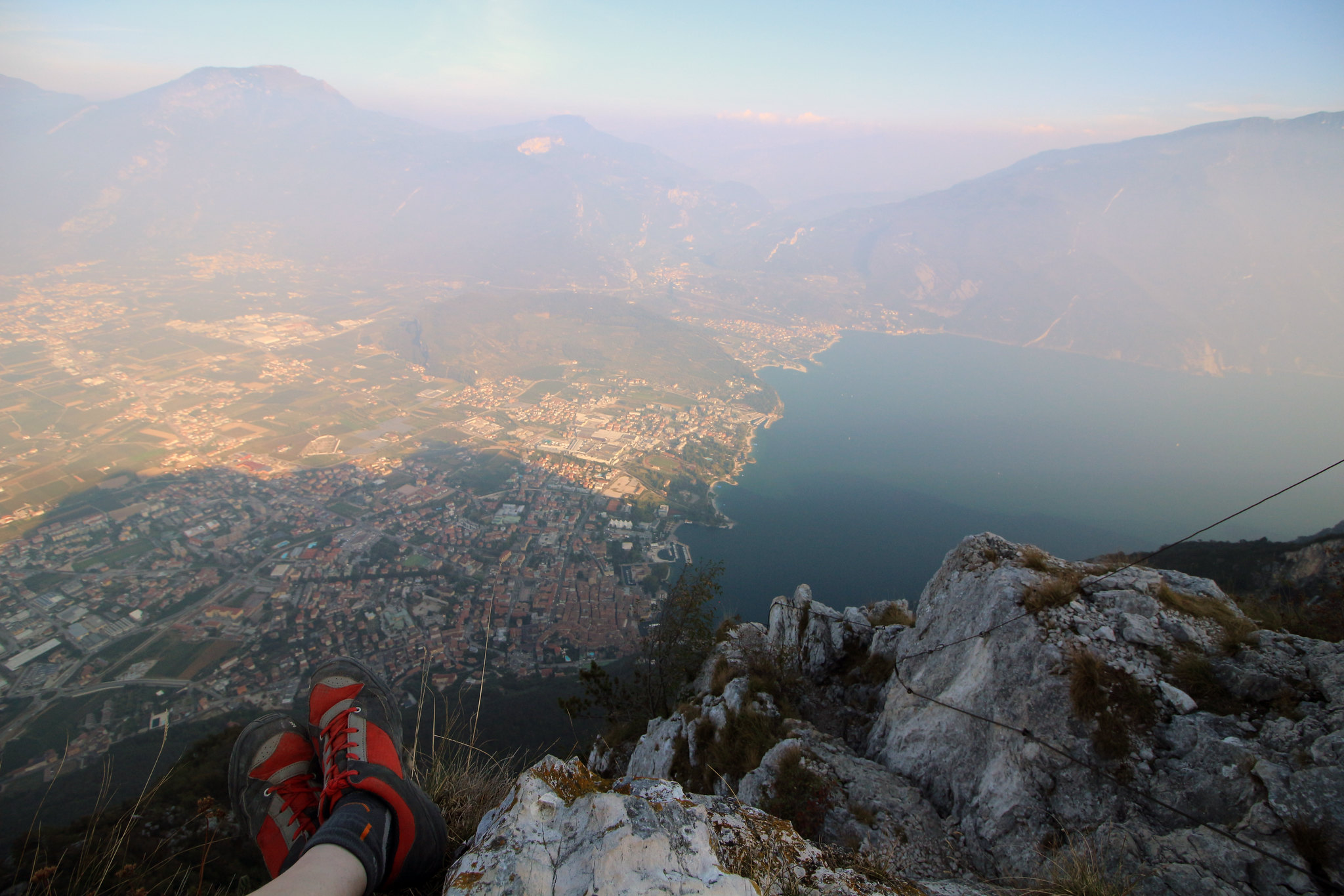
Eventually, after about 3 hours we reached the Via Ferrata, absolutely shattered. It started easy enough, with short sections of cable, but then snakes upwards quite sharply. There are some very exposed ladders, 110 metres of them in total, and these I found to be the most enjoyable part of the route. I have never experienced that level of exposure before, and there is nothing else quite like it. Hanging off a ladder hundreds of metres up, with nothing but air between you and the ground. It's odd and I did have to "give my head a wobble" at one point, found myself constantly stopping to admire the view, then working hard to catch Scott up.
 |
| Scott on a ladder |
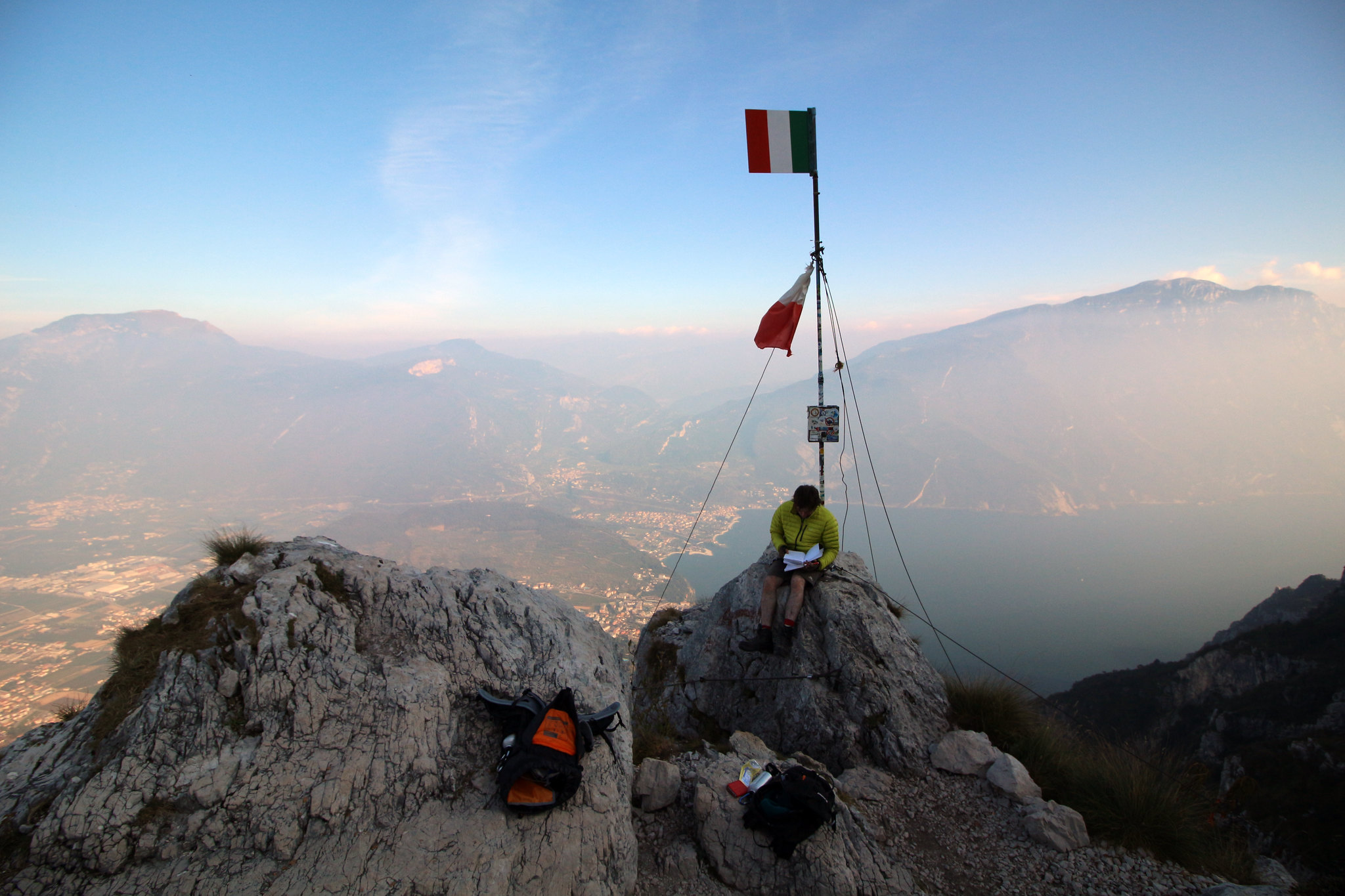
The summit at Cima SAT is 1245 metres above sea level, complete with Italian flagpost, and another log book to sign. It was an amazing summit, the views were spectacular and I would say totally worth the effort to get up there. Now we had to wonder, how long is it going to take us to get down from here? The answer was another 3 hours, all downhill with lots of scrambling, making our day on the mountain about 7.5 hours long. On the descent, we saw some old buildings left over from the war and the Santa Barbara chapel with huge shells mounted outside. We got back to the car just as it was going dark- thirsty, hungry and wondering where we went wrong, the guidebook said 5 hours. Nevertheless we came down from there with a real sense of achievement, and some awesome photographs.
 |
| Cima SAT |
Afterwards we realised that guidebooks can be misleading. The "Via Ferratas of the Italian Dolomites Volume 2" guidebook gives an estimate of a 1.5 - 2 hour walk in, with a total route time of 4.5 - 5.5 hours. Afterwards Scott had a look on the UK Climbing forum, and saw that a few others have complained of being misled by the book, and some people taking anything up to 10 hours to do Centenario! We stayed for pizza and ice cream in the postcard town of Riva, and for me a much needed glass of red. After feeding some ducks we drove off into the night, up into the real Dolomites. We needed to find somewhere to wild camp near our next destination, the Fassa Valley, and time was trickling away. The drive in the dark only hinted at the size of the mountains above us, I could make out the shadows looming high above the narrow twisting roads, and couldn't wait until morning to see the real Dolomites. After a long time of driving around several villages, we found somewhere quiet looking enough to pitch the tent off the side of a dirt track. There was some kind of unsettling drop next to us, but I was too tired to think much about it, finally falling asleep to the faint sound of water rushing far below.
I woke up far too early, quite cold, and to discover we had camped on the edge of a 30 odd metre high ravine with a river. Very high, snow-capped peaks were visible through the pine trees, and I enjoyed the early morning calm alone in the sunshine. Later as I was packing up some bits in the hire car, an Italian in a pick up stopped next to me and said "no camp", pointing at the tent. I apologised as best I could and said: "we go now". Yes, go now he says.
 |
| Col Rodella |
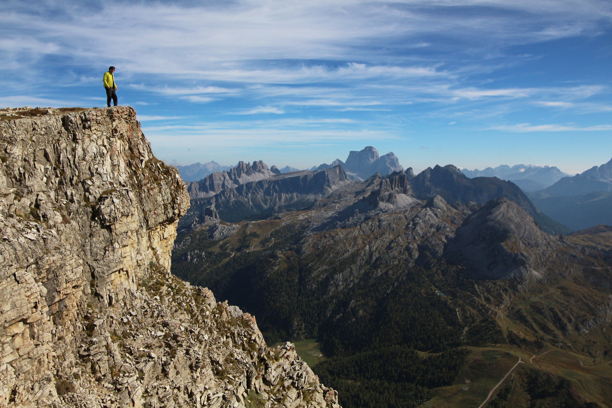
After drying the tent we packed up and headed to Val di Fassa. It has a big lift up to the Col Rodella, the area is popular for skiing in the winter, and there were plenty of paragliders making their way up with us. This was much more like it, get a ski lift to do the hard work getting up the hill, then a short walk over to the VF route. This was a well rigged, short, yet strenuous climb, and I had overdressed for the occasion so was very hot. I found 2 parts of the climb to be especially challenging and committing, yet completed the route with no issues. The views up here provide an incredible overview of the surrounding peaks. At 2,178 metres now we were talking mountains! After the climb, we walked down to the rifugio Friedrich August Hütte, which was open and busy, for much needed chips and ice cold cokes.